“You can continue to exercise alone, with one other person or with your household or support bubble. This should be limited to once per day, and you should not travel outside your local area.”
It’s early 2021, 9 months after Coronavirus spread into the UK, and here we are back in a national lockdown in England. The news that outdoor exercise can continue is a lifeline for many of us, but for those seeking adventure ‘’you should not travel outside your local area’’ is the big one. Staying local would be an obstacle to overcome. In the part of the Midlands where I live there is a particular lack mountain ranges and beautiful national park, but that doesn’t mean there isn’t adventure out there to be found.
Browsing Facebook late one night I came across an event shared by Alastair Humphreys called the OS Maps 62 Grid Challenge. The challenge was simple enough, run into 62, 1km x 1km grid squares on an OS Map and in theory you wouldn’t have to travel further than 6km from your house. I was excited to have a look to see if this were something I could complete. The event was set for three weeks from now and over three days, 5th – 7th February.
I went to search for my local map and unfolded it out onto my living room floor. My house is on the very bottom row of the map, so I would be limited to only going north in my search for local adventure. Now this was my local area, and I have been out running and walking a lot over the past year so many of the routes were familiar. Not to worry, half the fun would be in setting out the route to hit as many of the grid squares as I could.
About 3 hours later, still sat sprawled across the living room floor, I had 3 routes plotted out, colour coded, and grid squares marked off. 62 of them in total.

Day One – 11.55 miles – 20 Grid Squares.
Day one arrived. My plan was to explore these grid squares and not rush through the challenge. Although my GPS watch would be tracking my runs, I was purposely wearing a long sleeve t-shirt to cover up the screen so not to be tempted by minutes per mile and Strava segments.
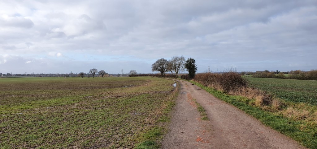
Heading north from my house it wouldn’t take long to make it on to the canal path, which would prove a much more scenic route out of town, whilst running through several of the more central grid squares. This part of the canal is paved so other than a few puddles it was quite easy running to get the legs warmed up.
The stretch along the canal wasn’t very far but it served its purpose as I reached the main road leading into town from the west. There’s a small private road that runs right next to the canal and it would be here I was heading next, where I would have a much larger puddle to deal with (the road was flooded), which involved climbing into some scrap land to keep my feet dry. This road was used as an entrance point for the railway network and running down it usually included a soundtrack of a rumbling engine from the nearby train station. Today there was also the shouts of the workman on the line, which reminded me that as bad as lockdown has been, normally I would be in an office on a Friday and not our exploring. I was thankful for that!
Passing under the railway bridge, avoiding more road wide puddles, I’d take a left turn onto Weddington Walk. Originally part of the Nuneaton & Ashby train line, it had since been reclaimed by the public and paved into a walkway running (like I was) all the way to Moira near Higham on the Hill. There is something quite wonderful about these old lines being repurposed into National Cycle Ways, connecting surrounding villages for walkers, runners and cyclists just like they would have centuries before for freight trains.
This particular route was the National Cycle Route 52 and was an area I’ve cycled along many times to get out towards the nearby town of Market Bosworth. Although this usually included whizzing through making the most of the traffic free shortcut, running it provided an opportunity to slow down and enjoy some of the views. Raised slightly from the fields surrounding the walk, you catch glimpses of the farmland spread far and wide through the treeline.
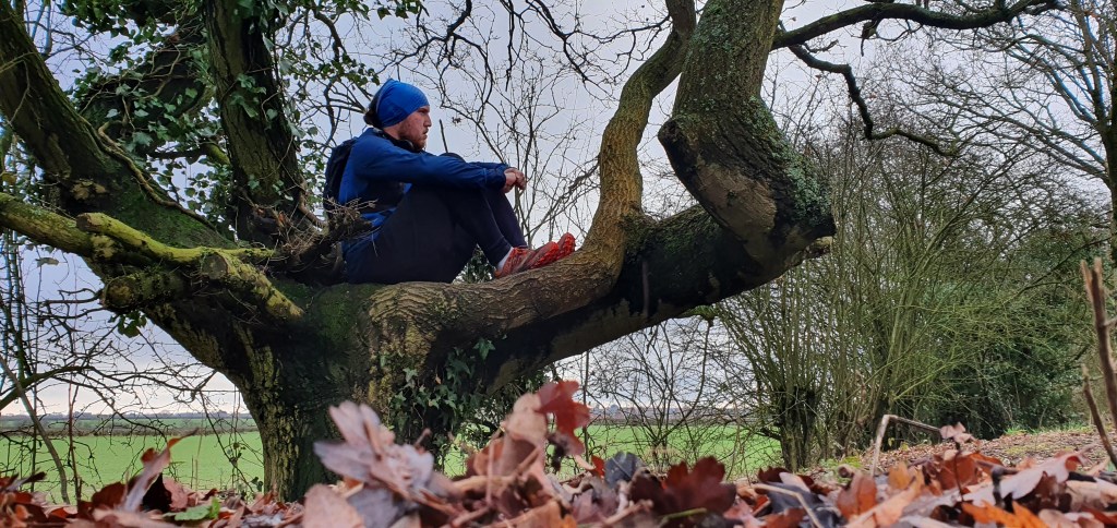
As I came to the end of Weddington Walk I made the most of particularly low hanging tree to sit and have a flapjack. A benefit of running any distance further then 10k is that you can eat whatever you like guilt free, in the optimistic assurance that its vital to fuelling the rest of the run.
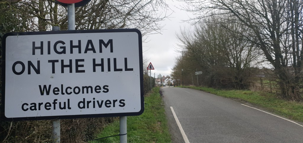
Before long I would make my way under the bridge beneath the A5 where a right turn would lead me to the village of Higham on the Hill. I would eventually need to get back onto the A5 but the 1.5 mile diversion into the village would bring me another 2 grid squares. It was also a much more pleasant run than the busy, traffic heavy stretch of the A5. There was no path into the village but the roads were quiet and the run peaceful. The stone bench outside the post office gave me a chance to sit down and have another (guilt free) flapjack. Leaving the village was back down a different road to the A5, about half a mile further along than I had left it. Running along noisy, busy roads is, at most, boring. So I put on my head phones and listened to some music to pass the short time on this part of the route.
Leaving the A5 would result in me taking a public footpath down into the nearby housing estate. This was the only part of the route that I wasn’t sure even existed when I was planning the route. It was marked on my OS maps as running alongside the driveway to a farm, but on both Google Maps and Komoot it simply didn’t exist. Even a quick run along Google Streetview didn’t provide any answers. It turns out the path was there, although now restricted to a narrow passage thanks to metal fencing put in place ready to build new housing. The nearby area of Weddington had tripled in size over the past 10 years and had now spread even further. It did leave me wondering how long it would be until most of the more remote area’s I’d ran through today would be lost to more housing as the town continued to grow.
The trail was muddy and wet and despite my best efforts to avoid all the puddles, I was left with wet, cold feet as I reached the end of the trail and into the housing estate. From here my route was rather bleak in terms of exploring. I was entering back into Nuneaton town centre and these roads were nothing but familiar. I weaved my way up and down streets as I zigzagged into as many grid squares as I could. Before long I was back near the town centre and would just need to run the 2 miles straight back to my house. I took a small diversion to run through the park rather than the main road and then it would be a nice long hill to finish for the day.
Day 2 – 13.37 miles – 19 Grid Squares
The next day I decided to start early to get the miles in. A friend was coming to run with me so I had arranged for him to meet me at my house for 7:30am. I gave him the choice of which route he wanted to of the two remaining and based on “it being quite squiggly” he chose the green route heading north west.
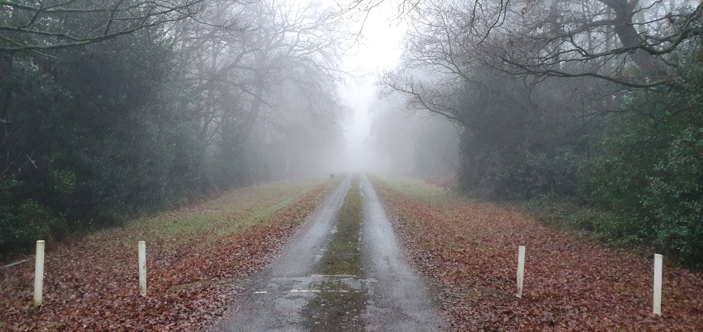
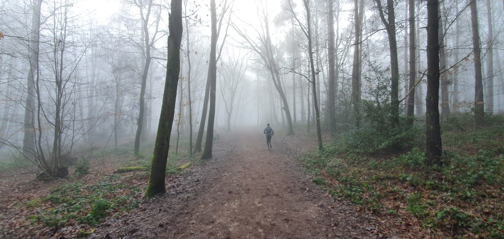
The day’s route involved running through a beautiful area of the borough, although we wouldn’t actually be able to enjoy much of these views and there was thick early morning fog set. The fog would end up being with us for most of the run.
From the off todays route was pretty much trails and the weather hadn’t improved much. It had actually been forecast to snow overnight but instead had just rained. The trails are pretty much just trodden area’s of the fields they run through and as the area was quite flat they can become waterlogged and muddy. Running on mud can prove to be quite difficult. Firstly the ground tends to move underfoot, so I was planting my foot into the ground differently to try and keep myself steady. Secondly this wasn’t working very well so I was sliding left and right to keep from falling over. This works extra muscles in your body that running usually wouldn’t which makes it feel like more work than usual. Finally with every step you lose some power as you push off and your foot slides away. This means you must work harder to move, but not actually move any faster.
The route continued to be trails along public right of ways, snaking through farmers’ fields. These sorts of public paths are not often used and it can be difficult to see where they are leading. This becomes a game of walking into a field, looking around for a piece of wood with the top painted yellow and hoping for the best it leads you in the right way. This game was made much more fun given the mist and lack of visibility. Essentially we were getting lost, but this is what the challenge was about. I’d come out to explore parts of my local area and what better way than finding these hidden trails a matter of miles away from where I live, even if it was by accident.
The route we were following was part of the Centenary Way. Me and my friend had walked 30 miles along this national pathway in the summer (although not this particular part). At the time we had exciting thoughts of historic routes undertaken by roman centurions. Turns out it was actually just put in place to mark the 100th anniversary of Warwickshire council. This was rather uninteresting, and it had seemed the council weren’t that interested either as most of it was run down and overgrown.
The mud was now reaching levels of ridiculousness and we were heading to an area called Hartshill Hayes, and as you could guess from the name, this was on top of a hill. This meant attempting to run up hill as a stream of water ran the opposite way. Annoyingly at times, I was sliding back down the hill and not actually managing to get anywhere.
A lot of mud, sweat and nearly some tears later we were in Hartshill and sat atop of the hill to enjoy some food and the wonderful view of… more mist! When I had set out I had said the miles would be slow, but the snail pace in some parts was past a joke. At least from here it would be mostly downhill and nearly mud free.
We stopped off at the shop in Hartshill to get a drink. We were now on 8 miles and a bit of a sugar boost would be welcome to get me through the remaining 5 miles. You can study as much sports science as you want, and analyse as much Strava data as possible, but it’s amazing how much forgetting about minutes per mile and eating plenty of food can actually help move your body much further than you think it could.
Similar to yesterday the route back home would be pretty uninspiring as I took what appeared to be pointless detours to tick off more of these invisible grid squares. There was one point where I would take a right turn to get to an area called the Black Track. My friend, wanting to be very helpful was insistent he knew a quicker route to get to the tunnel under the trainline we were aiming for. Trying to explain I had to take this right turn in particular to get another grid square he seemed to get offended that I wasn’t acknowledging his navigational skills.
The Black Track was another old train line which had been converted into a pathway for walkers. Surrounded by woodland and small brooks it was a popular walk in the area and made for a pleasant diversion before the final 2 miles through housing estates. Passing through the tunnel. under an actual functioning trainline, we were faced with another hill to get home. Pro tip: don’t live on top of a hill unless you want to undertake regular hill rep training. A series of pathways through parks meant we avoided having to run along any main roads and before long we were onto the final straight. The noticeable lack of mud had meant the final 5 miles had felt pretty easy and, feeling good I picked the pace up considerably. This is the closest I’ve come to experiencing the famed ‘runners high’ since the first time I managed a 5k without feeling like I was having a heart attack. I had to remind myself that I had another 15 miles to run the next day and jogged the final hundred meters to finish.

Day 3 – 15.01 Miles – 23 Grid Squares
The final day was not one I had been looking forward. It was the longest distance I would have to run and I already had 2 days of running in my legs. I was expecting my knee’s to be stiff and sore and this point, but thanks to a couple of cold showers I could at least still run without feeling too uncomfortable.
I was joined by a friend again today and set off at 7:30am to try and get it finished before lunch. The route today would be heading north east and, other than 1 walk along the canal, I hadn’t explored much of this area before. The canal was also a worry. It had rained a lot more overnight and the canal paths can become a mud bath. With 8 miles of mud running yesterday fresh in my mind I wasn’t keen on having to repeat it again today.
The first 4 miles would be based on the main road and involved running on the road a lot as there wasn’t a path in parts. This was one of the reasons I had to leave the longest route to the Sunday so that there would be less traffic. We made our way out towards to the local army barracks where we took a left turn towards Burton Hastings, a village that until that day I didn’t even know existed. I referred to it as a village but it was just a few houses surrounded by farmland.
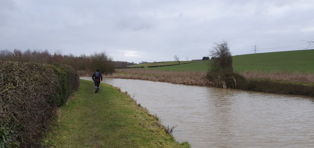
North of Burton Hasting and we would join the canal which would take us up to the halfway point. From the bridge I could already see the pathway was a mud bath and I thought to myself that I had probably chosen the wrong time of the year to be taking this challenge on. Once on the canal path it became obvious that the mud was going to cause an issue. Parts were so bad the mud was ankle deep and because the path is on a bank its runs on a slope. This meant that when I was running my standing foot was sliding down towards the water. Not only was this risking an injury, it was also likely to send me into the canal. I don’t mind a bit of multi-sport, but not when its unplanned. We decided we would run what we can and if needed we would play it safe and walk if needed. Before long it proved even this was a challenge and I scrambled up onto the farm field in search of level ground.
It looked like the canal stayed close to the farmland, so hoping we would be able to get back through at some point we decided run along the flatter land just to the left of the canal. Optimistic and motivated after seeing our last mile had taken 20 minutes we pushed ahead. A step over a fence led us into another farmers field and further along the canal. Eventually we reached the end of the field and was confronted with an inviting looking gate, 6ft tall and covered in barbed wire. It was 400 meters back to a clearing onto the canal which I didn’t fancy so I was keen to jump the fence. My friend was less keen. We had just decided to head back when I managed to find a slightly smaller barbed wire fence. I really didn’t want to run back on myself to I decided to jump the fence and wait it out whilst my friend ran around. In reality I probably used more energy trying to climb over the fence without cutting myself, but in my mind this would make or break the run.
As we re-joined the canal we were close to Hinckley and the A5. This part of the canal is quite busy and there are several docking points for canal boats, with a couple of pubs on the waterside. As this is more extensively used it has had gravel put down and meant we were able to run more smoothly for a couple of minutes.
A mile later (with another diversion for 2 grid squares) and we were back on the A5. There was a farm driveway we would need to follow which led to a public footpath, through a couple of miles of farmland. I could feel my legs tiring at the thought of running through more mud, but it didn’t come. The gravel road we were on ran pretty much all the way back to Nuneaton. This was a perfect example of why I was taking part in this challenge. I’d stumbled across 2 miles of open land that I had never seen before. I added this route to my itinerary of local running routes to be used again.
Eventually the gravel road swerved to the left and instead of following it back out to the countryside we headed into the housing estate. Neither of us really knew where we were but knew if we ran as straight as we could it wouldn’t be long until we were on a main road we would recognise. It didn’t take long and we came out about 2 miles away from my house. By now I had hit all 62 grid squares I had marked out and wouldn’t need to make any diversions. I took the direct route and headed home, my pace picking up again as I longed for a hot cup of tea and a sit down.
As I made it back to my front door, having run 39 miles in less than 48 hours, there was a clear lack of achievement you would usually get finishing a race or sporting event. This challenge wasn’t about speed. It wasn’t even really about distance either. It was about exploring your local area and that doesn’t have a definitive finish line. All the roads and trails and hidden tracks I’d explored for first time that weekend was just the start. These would make up foundations of future runs to come. More opportunities to explore what local secrets are hidden along the way.
A year ago I would be setting these runs to ‘private’ on my Strava profile, ashamed at my average pace for each run, but not today. Yes 1 mile took me longer to run than my average walking pace, and yes it took me 3 hours to run a half marathon. But it also allowed me to show a couple of friends part of our local area they had never seen before. One has even been and bought an OS map so he could do something similar. That’s why not only will these runs be staying on ‘public’. I am here writing about then, because if I can take a step back and appreciate just what my local area had to other then so can you.
Exploring local is something we can all do. You don’t need to run a half marathon a day like I did. Take a walk round the block and really look to see what’s there. You might surprise yourself with what you find.
Thanks for reading.
Karl

One thought on “Ordnance Survey Map Challenge”